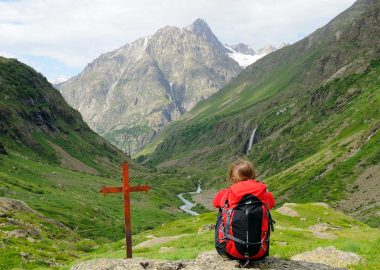
This itinerary is better known as the Tour of Ecrins and is a French ‘Grande Randonnée’ (Long hiking trail) at the heart of the Alps, around the number 1 National Park in France. You will be guided through the Ecrins mountains by the beacons along your way. You will not only cross through the French departments of Isère and Hautes-Alpes, but also the regions of Auvergne-Rhône-Alpes and PACA!
It all begins in Le Bourg-d’Oisans…
Le Bourg-d’Oisans is the official starting point of this trail and every summer attracts hikers of all levels of ability who set off on a few stages of the GR 50 or for the whole trail. For the whole trail, you will cover 363 km, an overall difference in altitude of 21,960 m and on average 20 days to complete it, meaning this GR trail is not suitable for all walkers, even if it isn’t as difficult as its ‘big brother’, the GR 54.
WHY NOT EXTEND THE PLEASURE
For those who are used to walking for an entire day, why not choose to do 2 stages of the trail with an overnight stay in a refuge, for your first taste of an extended hiking itinerary? To be able to do a ‘Grande Randonnée’, it takes practice, and the GR 50 is the ideal place to begin, around one of the iconic parts of the Alps.
WARNING
The GR 50 is currently being modified which is why some sections could be difficult to access due to a lack of maintenance. Make sure you find out about access conditions before setting off!
Go to the Website for the French Hiking Federation: FFRANDONNÉE – ISÈRE